


 The Solomon Islands
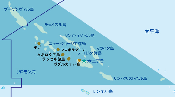
The Solomon Islands, located at the eastern end of the Coral Triangle consists of about 1,000 large and small islands, and has a land area of 28,900 km2, which is about 8% of Japan. The population is small with about 490,000 people living on these islands. The climate is considered to be tropical with the maximum daytime temperature at around 32 ° C throughout the year, it however drops to 20 ° C during nighttime. During rainy seasons, there are heavy rain like squall between January and April. There are diving attractions on Ghizo Island and Tulagi Island, however diving by cruise ship is considered to be the mainstream among tourists. The islands of Solomon are concentrated close to one another from the southeast to the northwest, so it is easy to move cruise ships between areas, and it is possible to select various direction courses. From the capital Honiara, it is common to travel around the Russell Islands where many islands are pinpointed such as the huge atoll Marovo Lagoon surrounding the New Georgia Islands, and the Florida Islands north of Guadalcanal. There is a cleaning station where several tens of manta ray gather, as well as a barracuda, a herring horse mackerel, and a flock of Green humphead parrotfish. There are many wrecks and complex terrain for you to enjoy along with mac diving. To the south of San Cristobal Island is Rennell Island, the world's largest island where coral atolls are raised. It consists of coral limestone raised from the sea, which is almost completely surrounded by a cliff from 120m to 150m. At the eastern end of the island is Lake Tengano, the largest freshwater lake in the Pacific. Rennell Island is also currently registered as a World Heritage Site because of its specificity with ecosystems isolated from the outside world.